We’re here to take care of all your asset monitoring needs to advance asset performance and lifecycle, increase safety, reduce energy consumption, and improve productivity levels across your business.
At Sahara, we’ve established partnerships with world-leading technology companies to deliver accurate, professional asset monitoring services to our clients in real-time.
Our services include satellite monitoring, Internet of Things (IoT) monitoring, UAV/drone monitoring, and more.
SATELLITE MONITORING
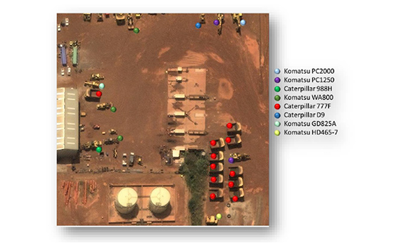
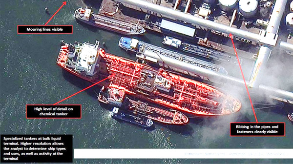
DigitalGlobe under Maxar can help with remote asset monitoring by using a multisource approach—including high-resolution satellite imagery, RADAR data layers and more to help keep tabs on your property holdings, infrastructure, and operations. By using this technology, we’ll help you get the complete picture, whether it’s in your backyard or halfway around the world.
By applying artificial intelligence tools and machine learning algorithms, imagery and data, we can yield critical insights about land use and land change, vegetation, the built environment and much more.
With our high-resolution satellite imagery (30cm) and analytics, you can easily monitor encroachment on properties, habitat changes and vegetation. Our cost-effective services cover a wide range of sectors including agriculture, utilities, government, mining, oil and gas, construction, just to name a few.
GLOBAL COMMUNICATION MONITORING
With our partner Inmarsat, we utilise a portfolio of global machine-to-machine (M2M) services which enables you to manage your remote assets and enhance your Internet of Things (IoT) applications. Full visibility and control of extraction and distribution infrastructure maintains productivity and ensures your commodity is delivered to clients on time. Our BGAN M2M, which is a 3G satellite network service along their distribution network, connects monitoring and control applications in remote, unmanned locations, giving you full visibility and management of your dispersed assets across an entire operational area. Our robust tools enable you to increase productivity and reduce operational downtime.
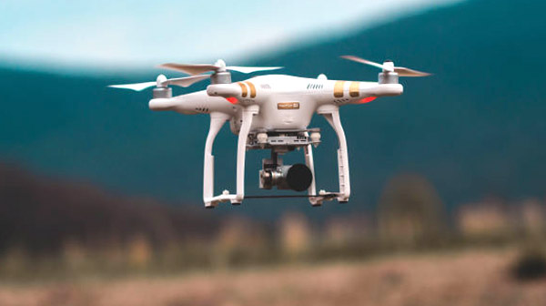
UAV/DRONE MONITORING
We have partnered with Wingtra, the leading manufacturer of Vertical Take-off and Landing (VTOL) drones, to provide in-depth insights on assets for monitoring purposes. The WingtraOne Vertical Take-off and Landing (VTOL) mapping drone is used by geospatial specialists and industry professionals to capture aerial images for a wide range of applications. Thanks to its hybrid VTOL design and high-resolution cameras (up to 42MP), WingtraOne provides aerial surveys of unparalleled image quality (down to 0.7cm/px GSD) and accuracy (down to 1cm). Survey times are also up to 80% faster than ground methods or quadcopter drones. Our asset monitoring solution using drones is useful in monitoring power assets, civil engineering projects, agricultural farmlands and assets, oil and gas assets, mining assets, and more.
Keen to learn more about how we can improve efficiencies in your business?
Contact us today about our Asset Monitoring services